Friday, December 30, 2016

Clover Valley Segment of the Ice Age National Scenic Trail

The Clover Valley Segment of the Ice Age National Scenic Trail (IAT)  runs 1.6 miles (2.6 km) through the Clover Valley State Wildlife Area near Whitewater, Wiscosin in Walworth County. After several good snowfalls followed by a good bit of rain and temperatures above freezing, a glorious sunny day appeared. With the sun came an opportunity to step through icy water and melting snow.

Wednesday, December 14, 2016

Connecting Route Storrs Lake Segment to Clover Valley Segment of the Ice Age Trail

The connecting route (CR) from the Storrs Lake Segment to the Clover Valley Segment of the Ice Age National Scenic Trail (IAT)  runs 9.3 miles (15 km) along country roads. With a careful eye, small arrows along the route at most turns can be spotted. 

Sunday, December 11, 2016

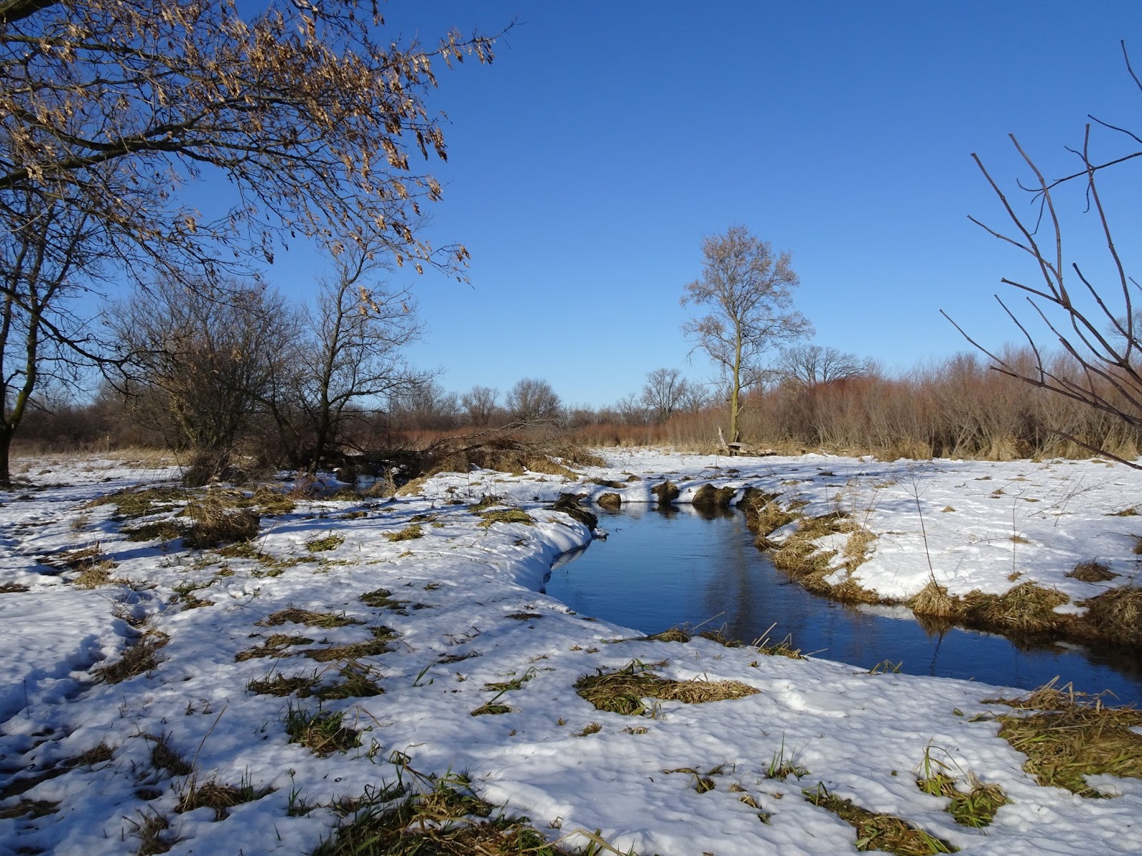
Storrs Lake Segment of the Ice Age Trail

The Storrs Lake Segment of the Ice Age National Scenic Trail (IAT) runs 1.9 well-blazed miles (3 km) through the Storrs Lake Wilderness Area with designated parking areas at both ends. Starting from the IAT parking area on N Bowers Lake Road, this short segment briefly follows and then crosses N Bowers Lake Road. The trail meanders through a hilly wooded area for a short time, then follows Bowers Lake until heading through the trees to the parking area on E Storrs Lake Road.

Saturday, December 3, 2016

Milton Segment of the Ice Age Trail

The Milton Segment of the Ice Age National Scenic Trail (IAT)  runs 4.4 well-blazed miles (7.1 km) between the Janesville to Milton Segment to the Storrs Lake Segment of the IAT. The trail runs directly past the Milton Family restaurant and other amenities through Milton. With short stretches in one direction or the other and plenty of variety, this Segment doesn't feel like the 4.4 miles that it is.

Wednesday, November 30, 2016

Janesville to Milton Segment of the Ice Age Trail

The Janesville to Milton Segment of the Ice Age National Scenic Trail (IAT) is about half road-walking and half hiking on a well-maintained railroad line converted into a multi-use trail. The segment runs 3.2 flat, easy miles (5.1 km). This segment falls between the Janesville and Milton Segments, hence the name "Janesville to Milton Segment".

Monday, November 21, 2016

Connecting Route between Janesville and Albany Part 3: Leonard Leota Park to Albany

Polishing off the new road walk between the Albany and Arbor Ridge Segments of the Ice Age Trail (IAT) feels great. After much road walking, I feel unexpectedly giddy at the thought of getting back to a bit of trail walking. I parked my car at the Sugar River Trail parking area at 701 4th Street in Albany, Wisconsin. I followed the IAT along the Sugar River Trail about a quarter of a mile. From here, the road walk began. 

Saturday, November 19, 2016

How to Make Your First Camping Trip with a Playdate in Tow a Success

Found a new trick for getting the kids to bed early on a sleep-over. Take them cold weather camping! With the sun down by 5:30 pm and an overnight low that dipped below freezing, they stayed busy and active, asked to climb into the tent early, and were snuggled in and sleeping by 8:30 pm. All of that aside, here's how we made our first camping trip with our child's inexperienced friend a success.

Thursday, November 10, 2016

Connecting Route Between Albany and Janesville Part 2: Gibbs Lake County Park to Leonard Leota Park in Evansville

With unseasonably warm November temperatures in the forecast, I continued the road walk between the Arbor Ridge and Albany Segments of the Ice Age Trail (IAT). When I began this road walk, I decided to try the new route west of Janesville in place of the old Highway A route. The Highway A route, known to IAT hikers as "The Dreaded A", runs east to west for about 21 miles and supports a relatively high volume of traffic. The new route detours through Evansville in place of the "Dreaded A", making Evansville the newest trail town along the IAT.

Monday, October 31, 2016

Spooky Halloween Fun Camping at High Cliff State Park

Sometimes the stars align and present wonderful camping weather. This was one of those times. We enjoyed a wonderful, spooky, fun October weekend camping at High Cliff State Park. Highlights included trick-or-treating along the Halloween Walk, hiking the trails, and a visit with relatives to admire their award winning pumpkins and long gourds.

Sunday, October 16, 2016

Family Backpacking Trip to Pictured Rocks National Lakeshore


Famous for its gorgeous rock formations and cliffs along the south shore of Lake Superior in Upper Michigan, Pictured Rocks National Lakeshore can be visited by tour boat, kayak, driving tour, or on foot. We chose the latter. With both campgrounds and backcountry sites available, we opted to backpack which may be done by permit at $5 per night per person. Pictured Rocks is located between Munising and Grand Marais on Michigan's Upper Peninsula.

Sunday, September 25, 2016

Connecting Route Between Albany and Janesville Part 1: Gibbs Lake County Park to Arbor Ridge Segment of the Ice Age Trail

As cool, cloudy mornings make for good road walking, one look at the forecast, and I decided to start on the road walk between the Arbor Ridge and Albany Segments of the Ice Age Trail (IAT). I opted to try the recently published new route west of Janesville in place of the old Highway A route, also known among some IAT hikers as "the dreaded A".

Monday, September 5, 2016

Boundary Waters 2016 - Little Indian Sioux EP#14 to Campsites on Shell, Hustler, Gebeonequet, Little Beartrack, and Loon Lakes.


The  BWCA (Boundary Waters Canoe Area) is the kind of magical place that casts a spell over visitors, drawing them back. Our family first visited the BWCA three years ago. We now return each year for our fix of loons, lakes, and love of the wilderness. Each year we add a day or two, and leave feeling that we could have used a bit more time.

Thursday, August 18, 2016

BOUNDARY WATERS 2016 BACKCOUNTRY MENU PLAN & FOOD PREP LIST

Warm, delicious meals around the campfire after a rainy day of paddling and portaging make the trip. Nothing feels better than sharing a well earned meal with the one’s you love while reliving the day and making memories.  On our trips, traditional family favorites like beef stroganoff and chili nourish the heart and fuel the body, while new treats add fun. Let’s gather around the food barrel, and find out what’s for dinner.

Monday, August 8, 2016

Camping at Lake Kegonsa State Park


Lake Kegonsa State Park on Door Creek Road in Stoughton, Wisconsin provides a nice venue for family camping near Interstates 90 and 94 with close proximity to Madison, Wisconsin. With around 5 miles (8km) of well-maintained hiking trails, campground and beach playgrounds, a beach and pet beach, and a boat launch, there is enough easy going fun to keep our family busy for a weekend.

Monday, July 11, 2016

Sylvania Wilderness Canoe Camping on Clark Lake, July 2016

In the Sylvania Wilderness, blue skies, plentiful wildlife, and the relative lack of 4th of July crowds made the mosquitoes much more tolerable. After a wet Memorial Day in the Sylvania Wilderness, our dry Fourth of July weekend felt great - not a drop of rain, cool nights, and sunny days. Arriving on Saturday afternoon, we unloaded and paddled 2.5 miles (4 km) across Clark Lake to the Birch  campsite. Tucked away in a little bay, not too many paddlers ventured by and we enjoyed relative privacy despite the holiday weekend and a fairly busy scene at the put-in.

Saturday, July 2, 2016

Family Camping Trip to Peninsula State Park

Peninsula State Park is located in Door County in Fish Creek, Wisconsin along scenic State Highway 42. Known as a hotspot for paddle sports, boating, bicycling, and outdoor theatrical productions at the Northern Sky Theatre, Peninsula State Park is Wisconsin's most popular stop for car camping. The park gets extremely busy, and we planned to arrive on a Sunday and leave on Thursday before the busy weekend began.

Wednesday, June 22, 2016

Father's Day Paddle on the Sugar River

On a bright sunny Father's Day we set out for a paddle on the Sugar River. I cast my vote for an early departure as the forecast called for hot, sunny weather. However, getting the family moving proved a challenge as our eight-year-old had enjoyed her first sleepover ever earlier in the weekend, so her tiredness slowed our pace. We finally got on the water somewhere around 11:00 am. According to my GPS we paddled an easy 8.5 miles from Attica to Albany on the Sugar River in Green County, Wisconsin. My husband's guidebook indicated something closer to 7.2 miles.

Friday, June 3, 2016

Sylvania Wilderness Canoe Canoe Trip - Memorial Day Weekend 2016

Our first family canoe camping trip of 2016 in the Sylvania Wilderness in Michigan's Upper Peninsula begins with a downpour. We paddle and portage what dry makes for an easy 4.3 miles (6.9 km) across Clark Lake and Loon Lake to our campsite, Eagle 1. Our daughter, less than pleased to have been caught in the downpour without rain gear on, puts her rain jacket on over her wet clothes. She then takes 30 minutes to drag herself across the normally 5 or 10 minute portage in the rain. It is clear we should have put on our rain gear before jumping into the canoe.

Monday, May 23, 2016

Janesville Segment of the Ice Age Trail

There is nothing like the fragrance of honeysuckle. Smelling of Fruit Loops and roses, no matter how many times I run into it on a hike, it is so fragrant I find myself looking around wondering who would wear so much perfume on the trail. Turns out honeysuckle lines the Ice Age National Scenic Trail (IAT) throughout the Janesville Segment. If you love the stuff, check out this segment in mid-May.

Friday, May 13, 2016

Camping at Hartman Creek State Park

Why do we return to camp again and again at Hartman Creek State Park? The park provides a great launch point for hiking the Hartman Creek Segment of the Ice Age Trail and canoeing on the Waupaca Chain O' Lakes. The park also has some nice trails for mountain bikes. The park is located west of Waupaca on Hartman Creek Road, south of State Highway 54 and north of State Highway 22. Due to our hectic work schedules and to much to do, we had only one night to camp and enjoy the fresh air.

Thursday, April 28, 2016

Hiking the Pike Lake Segment and Slinger Segment of the Ice Age Trail

Starting from the campground at the Pike Lake Unit of the Kettle Moraine State Forest, I hiked the Pike Lake and Slinger Segments of the Ice Age National Scenic Trail (IAT). The state park at Pike Lake offers plenty of parking options for these segments; however, a state park admission fee or annual state park sticker is required. The Pike Lake Segment of the IAT heads uphill hiked south to north, and downhill hiked north to south. As I am a back-tracker rather than a shuttler, I experienced both. The Slinger Segment is relatively flat.

Saturday, April 23, 2016

Camping at the Pike Lake Unit of the Kettle Moraine State Forest

The Pike Lake Unit of the Kettle Moraine State Forest, is located on Wisconsin State Highway 60 between Slinger and Hartland, Wisconsin. The park offers a beach, bike trails, camping, and plenty of hiking trails including the Ice Age National Scenic Trail. After another 5-day work week within this lengthy holiday-free span between New Year's Day and Memorial day, we packed up and headed out. We stopped in Hartland on our way into the park for a Cousins sub.

Sunday, April 10, 2016

Arbor Ridge and Devil's Staircase Segments of the Ice Age Trail

Hikers often say the worst part of hiking the Ice Age National Scenic Trail (IAT) is the road walk between the Albany Segment and Janesville. Using the unexpected layer of ice that accumulated on the back roads overnight as an excuse, I delayed getting started on this dreaded road march, and did a bit of trail hiking instead. After parking at the trail-head near the Janesville Schools Outdoor Laboratory, I hiked the Arbor Ridge  and Devil's Staircase Segments of the IAT. The day started out cold with trees and trails laced with snow that melted as the day wore on.

Sunday, April 3, 2016

John Muir Segment of the Ice Age Trail


The John Muir Segment of the Ice Age National Scenic Trail is a short, easy loop trail around Ennis Lake in Marquette County, Wisconsin. If you hike with small children, this 1.7 mile (2.7 km) loop is perfect. This segment is located in the John Muir Memorial County Park near the boyhood home of John Muir, founder of the Sierra Club.

Wednesday, March 23, 2016

Albany Segment of the Ice Age Trail


Upon my return to the Albany Segment of the Ice Age National Scenic Trail, unexpected snow and colder temperatures greeted me. I expected quiet, but the sounds of numerous birds, particularly through the Albany Wildlife Segment greeted me. Owls, turkey, geese, sandhill cranes, red-winged blackbirds, and numerous songbirds continuously filled the air with song. A mink crawled up from a swampy area behind a home near bridge 13, took one look at me, and scrambled off the trail.

Saturday, March 12, 2016

Preparing Dehydrated Foods for Next Summer's Wilderness Adventures

Cold winds howl. The urge to hunker down at home and keep warm strikes. What do you do? Enjoy a nice warm pot of of chili, spaghetti, beef stew, or beef stroganoff and dehydrate the left-overs for your next wilderness adventure. Lightweight, well-preserved, home cooked foods for your back-country adventures prove far more satisfying, contain more protein, and taste far less salty than the prepacked options.

Sunday, March 6, 2016

Albany Segment of the Ice Age Trail

Spring is most certainly on its way on the Albany Segment of the Ice Age National Scenic Trail. After a number of silent winter hikes, the cacophony made by geese, sandhill cranes, and various songbirds, made for an unexpected but welcomed surprise. I parked at the Old Train Depot on Pratt Road in Monticello, WI and headed east.  The Albany Segment of the IAT follows the Sugar River Trail from Monticello to Albany, WI. It is an easy hike, along an easy to follow, well-maintained, flat multi-use trail.

Saturday, February 20, 2016

Monticello Segment of the Ice Age Trail

To hike the Monticello Segment of the Ice Age National Scenic Trail, I parked at the Old Train Depot on Pratt Road in Monticello, WI. The parking lot is large with restrooms and refurbished buildings, all currently closed for the season. The Ice Age Trail (IAT) is not yellow-blazed on this segment, but the multi-use trails it follows are easy to find and follow. Heading north, I crossed County Highway C, and transitioned from the Sugar River Trail to the Badger State Trail. Not switching to the Badger State trail would have resulted in a walk to New Glarus rather than a walk through the Stewart Tunnel.

Sunday, February 7, 2016

Connecting Route from the Brooklyn Wildlife Segment to the Monticello Segment of the Ice Age Trail

On a gorgeous February Sunday, I parked in the Hughes Road parking lot at the Brooklyn Wildlife Area trail head. I began walking west on Hughes Road, south on County Highway D, then west on Wisconsin 92 / County Highway W to the Monticello Segment of the Ice Age Trail. After completing the connecting route between the Brooklyn Wildlife and Monticello Segments of the Ice Age Trail, I headed south on the Monticello Segment to Tunnel Road, before back-tracking back the to car.

Monday, January 25, 2016

The Brooklyn Wildlife Segment of the Ice Age National Scenic Trail

Section hiking the Ice Age National Scenic Trail (IAT) is my winter treat. At the pace I'm going, looks like I'll enjoy this treat for many winters to come. After parking on Frenchtown Road at the tee made with Pillar Road in Belleville, I began to hike the 2.5 mile (4 km) portion of the Montrose Segment leftover from my last IAT hike before heading into the 3.5 mile (5.6 km) Brooklyn Wildlife Area. As I stepped from the car I enjoyed watching the fat, red moon from the night before setting and heard an owl call.

Sunday, January 17, 2016

Montrose Segment of the Ice Age Trail


Astronomical twilight tempered the darkness to a nearly imperceptible extent as I parked at the Badger State Trail parking area on Sayles Trail. Able to see only a tunnel of white heading into a sea of black and the twinkling stars above, I headed south on the National Scenic Ice Age Trail (IAT). This portion of the IAT overlaps with the Badger State trail, a 40 mile multi-use trail that travels from Madison to the Illinois border.


Sunday, January 10, 2016

Connecting Route from the Verona Segment to the Montrose Segment of the Ice Age Trail


Snow flurries greeted me as I began to walk the connecting route between the Verona and Montrose Segments of the Ice Age Trail. Although the traffic roars on County Road Pb, the remainder of the walk proved pleasant with little traffic. After parking at the Prairie Moraine County Park on Wesner Lane just off County Road Pb, I walked south on County Road Pb, east on Sunset Drive, south on Borchert Road, and east on Purcell Road to the Badger State Trail. This road walk ranks an easy 2.9 miles (4.7 km), 5.8 miles (9.3 km)  considering of the walk back to the car.

Sunday, January 3, 2016

The Verona Segment of the Ice Age Trail

The Verona Segment of the Ice Age National Scenic Trail (IAT) provides a 6.4 mile (10.3 km) stroll through county parks and suburbia, with convenient places to hop off-trail for a bite to eat. The trail meets up with various other biking and hiking trails along the way, crosses several roads, and follows along County Highway M for a time.

Friday, January 1, 2016

Reflections on 2015

So much changes in a year, and so much stays the same. Jobs and people come and go out of our lives, but our wild places, our places of beauty and solitude, remain. With so many truly beautiful outdoor spaces to be thankful for, many of them close to home, I feel blessed. It is my hope that by sharing my love of these places, others will come to love them as well, leading to their preservation for future generations.