
This segment of the IAT splits two sections of foot path joined by country roads. I began with the hilly 0.8 mile northernmost footpath hoping a little extra exertion on the hills would help warm my travel. I found this stretch of trail satisfying with views above and alongside 3 small undeveloped lakes.


I began near Grenlie Lake and hiked along the lake. As the sun began to rise, I followed the trail upward for a sunrise view toward the east of Grenlie Lake below. As I continued hiking through the hilly area I saw Foster and then Skunk Lakes. I continued along the trail until I had looped back to N. Foley Road about a quarter mile from the trail head. I really enjoyed the hills, kettle lakes and views along this portion of the trail and thought it would be nice to come back in spring and check out the wildflowers.

Trailhead

Someone left at trailhead

Grenlie Lake

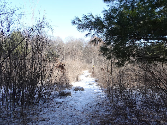
Foster Lake

Sunrise

A beautiful morning
I returned to the trailhead and began to head around Grenlie Lake in the other direction across the wooden bridge along the IAT. Soon I was taking the road walk from N. Foley Road to Indian Valley Road to pick up the other foot path portion of the segment. On Indian Valley Road, in front of one of the residences 4 large dogs blocked the road; barking and growling. I called out for the resident to call the dogs off so I could pass, but the resident refused. I walked back to my car and drove it to the head of the trail on Indian Valley Road and started the 1.8 mile section of footpath.

Grenlie Lake

Grenlie Lake

Ready to start the connecting route
After passing a cell tower the trail headed through a wooded area, crossed a country road, and followed alongside a field, then through more trees over one of the Farmington drumlins. Erratics decorated the trail through this portion which headed through wooded areas and along fields. The terrain was a bit hilly and traveled over a drumlin before following a field towards another wooded area. Towards the southern terminus, with a large farm in sight across a large field, the trail deviates from the map in the Ice Age Trail Guidebook. The trail follows the edge of the field westward to N. Foley Road, and then heads south terminating with a road walk to US Highway 10.

Trailside Tower

Along the southern portion of the Skunk and Foster Lakes Segment of the IAT

Heading west towards N. Foley Road

The trail no longer heads south along the farm, instead goes west to N. Foley Road

Along N. Foley Road

Large Granite Erratic

Signage for Farmington Drumlins

Beautiful sunny day

Interesting relationship between a tree and an erratic

Along the Skunk and Foster Lakes Segment of the IAT
When I reached US Highway 10, I turned back and hiked the route in reverse. When I reached the car I kept going to finish the roadwalk the dogs had prevented me from completing a couple of hours earlier. That's all for now. Let's get outdoors and keep our wild places wild.

Map
Total Distance Covered - The Skunk and Foster Lakes Segment of the IAT is 4.4 miles (7.9 km) one way.
Difficulty - Moderate - some hills.
Difficulty - Moderate - some hills.
Trail Conditions - The trail is well-blazed. Ran into no other hikers on the trail, 8°F (-13°C).
Highlights - The Farmington Drumlins, a few gorgeous views of Grenlie, Foster and Skunk Lakes.
Total Ice Age Trail Miles to Date - Total official trail distance completed to date - 607 miles (970 km).
Amenities - Trailhead parking at the Skunk and Foster Lakes State Natural Area on N. Foley Road.
Location - Near Scandinavia, Wisconsin.
No comments:
Post a Comment