
I parked at Zander Park in Two Rivers, which is about a block away from the trailhead signage at the terminus of the Dunes Segment of the IAT located where 12th Street and Columbus Street meet. I headed over to the signage, and started walking east on 12th Street through a residential area. A massive white water tower stood amidst small homes and an Elementary School. As I headed east I exited the residential area and passed between the Historic Farm Museum and Kahlenberg Industries, and then continued east.


At Highway 42 (Washington Street) I headed north and crossed the West Twin River, seeing McDonalds, Subway and other businesses positioned nicely to serve hungry hikers. When I arrived at the corner of Highway 42and 17th Street, I realized I had missed at right turn on East River Street, so I headed east on 17th Street. I passed the historic Washington House, a former hotel which is now the Two Rivers Visitors Center. This is said to be the birthplace of the icecream sundae, and sundaes are still served at the Washington House in Berner's Icecream Parlor. From the corner of 17th Street and Jefferson Street, I rejoined the IAT, and crossed the East Twin River. admiring the views.


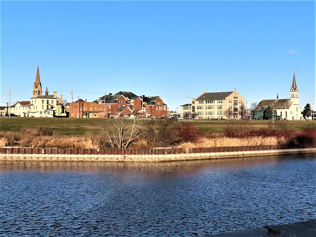
After crossing the river, I headed southwest on East Street enjoying views of beautiful downtown churches and architecture across the river. At Harbor Park and the Coast Guard station, I turned to continue northeast onto Harbor Street. At 16th Street I headed east towards Lake Michigan. I followed Zlatnik Drive along Lake Michigan north through the Neshota Park area, passing the Rotary Pavilion and taking in views of gorgeous blue skies, white sand, and feeling cold gusts of wind blowing across Lake Michigan. Heading away from the water, I found relief from the cold winds. I followed 22nd Street to the east, Neshota Drive to the north, and then Park Road to the northeast until I reached the terminus of the Two Rivers Segment and then start of the Point Beach Segment of the IAT.


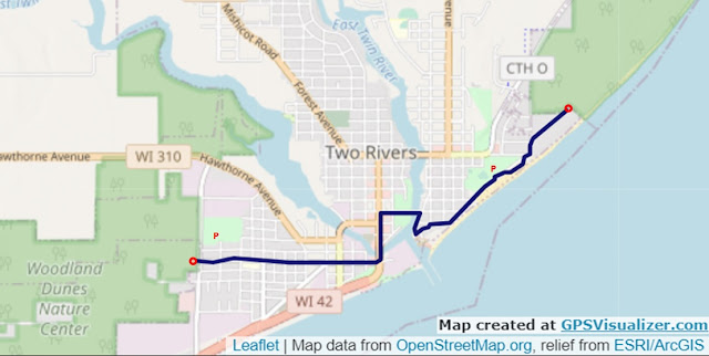
Map of the IAT through Two Rivers
That's all for now, let's get outdoors and keep our wild places wild.
Difficulty - Easy.
Trail Conditions - The trail traverses sidewalks, foot paths, and roads through Two Rivers' residential areas, downtown and along the waterfront, 25°F (-4°C).
Location - Parked at Zander Park.
No comments:
Post a Comment