More often we find circumstances rosier in reality and drearier in the worry. Surely this would be the case. Determined to find adventure in the adversity and hoping for much more good luck than bad, our family headed north.
Day 1: The Adventure Begins
Day 2: Reducing Food Barrel Weight Bite by Bite
On day 2 we did a fantastic job of eating some weight out of our food barrel, rested up from Day 1, and relaxed. We watched the morning fog dance and twirl over Phoebe Lake, drying up later when the sun shone through. I made dehydrated hashbrowns and precooked bacon for brunch.
A foggy morning on Phoebe Lake
Bacon and hashbrowns, day 2
The family of swans
My husband and Ams played games as I cooked. After lunch they enjoyed some hammock time, while I watched the pair of swans with their cygnet making their rounds. When the swans moved away, I took a swim to rinse off. We all saw a garter snake gliding in and out of the tickets of brush along the campsite. As Ams lay quietly in her hammock, she saw the snake take down a small rodent, she thought maybe a mouse or a chipmonk. We had been alone on Phoebe Lake the night before, but this day we saw campsites fill and a handful of groups coming across Phoebe Lake.
Although we didn't do much, the day passed quickly. I cooked dehydrated enchilada rice with dehydrated ground beef, cheese, and crushed Fritos for dinner. We talked about heading west to Polly Lake in the morning and targeting campsite 1073 on the north end of Polly Lake coming off the Phoebe River. We saw traces of smoke from the wildfires in the air, but it all seemed distant. Once again we did not see much of a sunset.
Day 3: Low Water Woes
The vibrant sunrise on Day 3 lit the sky with magical ribbons of pink. We ate a quick breakfast of granola, granola bars and jerky, then started breaking camp. We had heard the Phoebe River on our way to Polly Lake would be even worse in terms of low water than the portion we had encountered on Day 1. In this case, it would take some time to get to Polly Lake. With this being a popular destination, we sent our intentions on an early start.
Easy to look at the sun with all the particulates from wildfires in the sky
Although too early in the morning for wasps, several had been hanging out under our rainfly and circled me madly as I worked to take down the tent. When I went to unclip the tent from a tent pole I found out the hard way one of these wasps had settled on the far side of a tent pole. I swallowed a precautionary Benadyl and moved on with pack up more carefully.
We paddled off into the hazy morning heading northwest towards the channel into Knight Lake. On Knight lake we saw loons fishing, swans flying, and four vultures eating from a rock. We supposed someone must have left a pile for fish guts on that rock. West of Knight Lake, we got back onto the Phoebe river.
We did a carryover on a rocky area with a beaver dam and did some lining in shallow rocky areas. After getting through that, I did a bang-up job of running us into shallow rocks and getting us stuck in shallow spot after shallow spot. We were in and out of the boat, lining and not lining, again and again. Hot, dirty and tired, we were relieved to finally arrive on the 144 Rod portage from Knight Lake into Hazel Lake.
Waiting to take the 99 rod portage from Phoebe River to Lake Polly
The day grew hotter. When we arrived at the portage from Phoebe River to Lake Polly, two boats were in the water blocking entry to the portage and we took a long break waiting for the people belonging with those boats to come across the portage - a family with two teenaged girls. When we finally reached the other end of the portage the holdup became obvious. A big group of boys for the girls to chat with were taking a break and blocking egress on the other end. We had arrived at a busy popular lake.
With the access to Lake Polly blocked by the boys group taking a break, and with all of their stuff blocking passage except in one small spot, my husband squeezed by to the small spot needing to set down the canoe. He stepped into the lake at this only open spot and found himself in more than waist high water.
Off we went. We wondered after running into all of those people did we dare hope for a campsite on the north end of Lake Polly? Did we dare hope for exactly the site we aimed for?
Day 3 Map
We paddled on. Feeling free and grateful to be through carrying over rocks and getting stuck in muck, we enjoyed the simple movement of paddling unobstructed water. The rain began to clear up and the sun came back out. Now hot, sweaty, and tired, we felt ready for a campsite. As we rounded the last slight bend, we saw our target campsite open. Unbelievable our luck! We worked hard and saw our reward - campsite 1073, open!
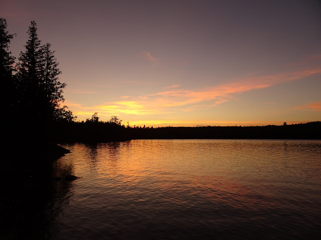
A spectacular Lake Polly sunset
In camp, I make dehydrated sweet and sour rice with peas and chicken. After lunch, my husband hung the bear barrel and set up the tarp. Ams and I set up the tent and I did dishes. The day grew hotter, windier, brighter. My husband and I took a swim to cool off and Ams relaxed playing games on her phone. We made plans to head northwest in the morning, over to River Lake. We would try and take the campsite on the south end of the island on River Lake (Kawishiwi River). We talked about our unbelievable luck having our chosen campsites available on lakes so close to entry points. A spectacular sunset over Lake Polly that evening made for a perfect ending to a great day in the BWCA.
Day 4: Fire in the Sky
On day four I woke to a cold, rainy morning thinking I'd go about my business in the light rain. Then it began to rain hard, with some lightning and thunder. I felt glad to see the rain. The BWCA needed the rain, some relief from the drought. I moved as much of our stuff as I could into the dry spot under the tarp, and huddled there munching granola. After an hour or two, the clouds cleared up and the day grew windy and bright.
We loaded the canoe and paddled north to the short 17 rod portage to the Kawishiwi River, where we paddled, took a 54 rod portage, and paddled again along the Kawishiwi River to the 115 rod portage into Koma Lake. The Kawishiwi River wasn't without its low water challenges. We found ourselves hopping out to line the boat time and again, sometimes on solid river bottom, sometimes uncomfortable with the amount of sinking into the muck the job seemed to require. None of this proved as challenging as the Phoebe River had been on Day 3. Perhaps we encountered less of this, or maybe we became accustomed to the grind. The portages in this area were wide, well-traveled, and surprisingly dry. As rainy as it had been, it hadn't taken long for the morning to become remarkably dry as if the rain had never happened at all.
Kawishiwi River
The wind felt strong on Koma Lake, a relief from the hot sun, but a gusty headwind challenged us. We did see a swan on Koma Lake, and did plenty of submerged boulder dodging. We paddled hard across Koma Lake towards one of my favorite portages in the BWCA.
Surprised to find no water in the rapids on the portage from Koma Lake to Malberg Lake
We crossed the 27 rod portage from Koma Lake to Malberg Lake. This portage goes around a very rocky area featuring an especially big boulder in some shallow rapids. This favorite spot offers unique beauty and a fun place to hang out for a snack and to take a photo break. We skipped the snack, but took our obligatory photos and walked around admiring the rocks, exclaiming how it looked like an entirely different place with no water in the rapids, not even a trickle. Soon it was time to paddle across Malberg Lake.
Malberg Lake
The bay at the end of the portage felt quite calm, but as soon as we paddled out into the more open part of Malberg Lake, gusty wind picked up. Malberg being a popular lake, we expected full campsites. While we did cross paths with just one group traveling, we saw no one on any of the Malberg Lake campsites. We dug in all the way on Malberg and exhausted ourselves fighting the wind. Portaging never felt so good as we finished paddling Malberg Lake and begin to portage from Malberg Lake to River Lake (Kawishiwi River).
This portage felt longer than the 64 rods marked on the map. Along this portage we carried, floated a narrow channel, and carried again. Of the day's portages, it was only this portage that remained wet and muddy from the morning rain. When we arrived at the River Lake end of the portage, the water had dried up. We went from one low water landing to the next looking for a place to put in. After a time, we found a shallow but very mucky spot and gave it our best.
After having crossed paths with only one other group all day, and seeing no one in camp on Koma Lake or Malberg Lake, we were surprised see a large group taking a lunch break at the first campsite on River Lake. As we paddled River Lake towards our desired campsite, we began to see more and more boats and to find each campsite we passed on River Lake occupied.
Day 4 Map
In camp on River Lake
The gusty winds blew hard, making the heat of the day more bearable. We hid in a low spot in the trees to escape the wind for cooking. Rigging the tarp in the wind on high perched kitchen area proved a challenge for even an experienced tarp rigger. My husband accomplished his mission, but the wind did not make it easy.
I made dehydrated Mexican rice with dehydrated ground beef and crushed Fritos for lunch before I turned my attention to setting up the tent. Exploring the campsite, we found it had a number of separate zones. We were able to travel the shore a good distance in either direction. North of the campsite was a bay with a beach, likely not there during times of normal to high water levels. The camp kitchen perched high on rock overlooking river lake for miles in either direction. The site held a number of good tent pads, one of them under dangerous trees.
The sunset over River Lake looks like fire in the sky
I enjoyed a swim on the beach to cool off and laid on the warm rock near the kitchen as the strong wind and hot sun dried my clothes and hair in about 10 minutes. We all rested and relaxed and time for cooking our spaghetti dinner came quickly. As the wind blew hard out of the northwest, our eyes began to burn and the wildfire smell grew stronger. The sunset looked like fire in the sky and once the show in the sky ended we retired to the tent.
Goodnight Day 5
Day 5: A Good Day to Just Be
Day 6: Beautiful Boulder Lake
Day 7: Firefighters in Flight
I've never seen a sunrise quite like our 2021 BWCA Day 7 sunrise on Boulder Lake. The fog and the smoke particulates in the hazy air created a mystical, dazzling array of color. The views grew brighter and more amazing with every passing minute. The views captivated me. I found it difficult to shift my focus towards breaking camp.
We aimed to get an early start to beat the forecasted afternoon heat and wind gusts up to 35 mph. This day we targeted a campsite on a peninsula towards the northwest end of Little Saganaga Lake. We quickly ate granola, granola bars and jerky for breakfast and pushed off. By the time we paddled north on Boulder Lake the fog had dissipated. The sun shone bright and warm, and the winds had not yet started.
Boulder lake
We portaged 185 rods to the north and headed east on the Cap Lake - Ledge Lake portage for an additional 100 rods. Somewhere within the 185 rod portion, there is a float through. We found none of it floatable. With the drought the water was very shallow in spots and for the most part nearly dried up. But dry does not mean solid. My daughter Ams sunk to the top of her boot once, and I felt lucky to get her free with her boot still in her possession.
Just after Ams became unstuck from the mud, we had a mucky creek bed to cross. My husband post-holed into the muck near the creek bed with the canoe on his shoulders and a large pack on his back. Another mini crisis and another stroke of luck, my husband recovered his shoe as well. What a relief to be single portaging and not have to cover this ground again a second time. This confirmed how well worth giving up some of our little luxuries had been. After crossing the creek, we went up a steep hill. We felt hot, sweaty, and very happy to be on solid ground.
We portaged until we met the Cap Lake - Ledge Lake portage where we turned right for an additional 100 rods. Still early and with only one portage complete, we found ourselves already very warm and tired. The excitement of post-holing behind us, we took a short break on the landing at Ledge Lake to catch our breath. The mucky landing and shallow lake with pea green water did not appeal, I felt glad we had no plans to camp on Ledge Lake. We paddled east squinting against the bright morning sun, then did the 149 rod portage from Ledge Lake to Vee Lake.
Leaving Ledge Lake on the portage into Vee Lake
The portages were fairly narrow, a bit overgrown in spots, but perfectly usable. The 67 rod portage from Vee Lake to Fee Lake isn't particularly difficult, but I imagine it might have been rather wet and buggy if the area hadn't been in a drought condition. The portage goes through and around some rather low lying areas and a small swamp. When we loaded the canoe, I missed my water bottle and retraced the portage to retrieve it. It took some searching and I felt lucky to find it in the thick undergrowth after what felt like a lengthy hunt. Thankfully this would be my only double portage of the trip.
Hoe Lake
The breeze picked up a little bit on Fee Lake and we continued east towards the bright sun. After a 50 rod portage from Fee Lake to Hoe Lake, we continued to paddle east and the wind continued to strengthen. On the 76 rod portage from Hoe Lake to Makwa Lake it felt strange to run into other paddlers. We had really begun to feel alone. A very short paddle on Makwa Lake delivered us to the 59 rod portage into Elton Lake.
Little Saganaga Lake
We paddled north on Elton Lake seeing no one. A nice break from paddling directly into the bright sun. At this point we started feeling tired. As we neared the portage, the beautiful cliffs to our left drew our attention.
There are two ways to get from Elton Lake to Little Saganaga Lake. You can take two small portages with a shallow float between the two (a 33 rod and a 20 rod) or take one longer portage of 131 rods. Due to the trip's trials with mucky, shallow areas due to low water and post-holing earlier that day, we opted for the longer portage to avoid the potential for getting stuck and sinking into the mud. Based on it being the most overgrown portage of the day, I presume most people choose the route with the two small portages and the float through.
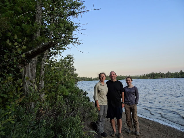
At the landing of our campsite on Little Saganaga Lake
The 131 rod portage into Little Saganaga Lake behind us, we felt hot, tired, and ready for a campsite. The forecasted windgusts of 35 mph had not started yet, and this felt like a stroke of luck. The day now felt very hot and we needed a bit of rest. Being so close to our target campsite, we decided to push now and rest later.
Day 7 Map
The lake looked like something out of a fairly tale with it's islands and rocks in juxtaposition with the gorgeous blue water and sky and green hills. As we paddled the lake we noticed all the campsites stood empty and our excitement and the thought of getting our target campsite motivated us to paddle hard despite our being now hungry and tired.
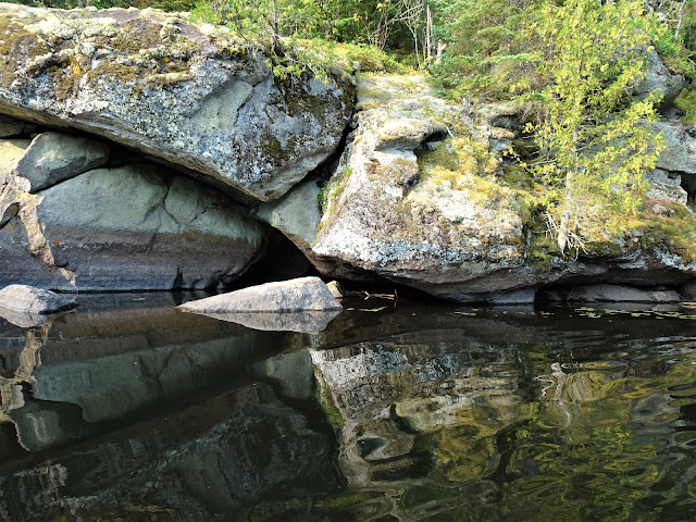
Tree split rock on the sand beach below campsite #812
We landed on the sand beach below Campsite 812 still having seen no one in any of the campsites on Little Saganaga Lake, and went up top to claim our victory. We could not believe our luck, so far on this trip we had found every target campsite on every target lake available for the taking.
As we got ready to make lunch, the wind picked up dramatically. We had made it across Little Saganaga Lake just in time to avoid the promised 35 mph wind gusts that now blew through camp. The campsite had a view to the south. Walking the beach, views to the south and east could be had. Gusty winds blew out of the south and southwest. Walking behind the latrine to the north also provided another beach area with a perfectly still bay, a direct contradiction to the gusty winds out of the south in camp and on the beach on the south side of the peninsula.
Lunch - Loaded backed potato soup
For lunch I prepared Idahoan Loaded Baked Potato soup garnished with bacon bits. Then we explored the shoreline and took a swim to cool off. Later in the afternoon we began to spot planes circling across the lake to the south.
Before long, the planes were on Little Saganaga Lake scooping water and flying to a spot south of camp across the lake maybe a couple of miles from the south shore. After a time they began to go further north for water, to Gabimichigami Lake, flying low and directly over our campsite each trip. We watched the show for a while and wondered how concerned we should be about wildfires nearby. In the end, we decided we had a large body of water between us and the south shore, and that a fire was likely a couple miles south of that.
View to the south from camp looking towards what we later learned was the John Eck fire
Eventually we grew tired of watching the firefighters in flight and decided to cook dinner. For dinner we made a Mountain House Chicken Fajita Bowl with flatbread. We went down to the north facing side of the peninsula to watch the sunset and hide from the wind, and then turned in for the night as a campfire was not an option.
Day 8: A Beautiful Day on Little Saganaga Lake
Day 9: Wildfire Feeling Closer on Mesaba Lake
Day 10: Homeward Bound
On the last day of our 2021 BWCA canoe trip, we woke to another warm, hazy day. Today we aimed to beat the forecasted afternoon heat and high winds. Our longest portage of the trip, the Zenith Portage, would be great to finish before the heat set in.
Hug Lake
Duck Lake
Zenith Lake, getting ready to do the Zenith Portage
We started the 444 rod Zenith to Lujenida Portage, starting with a hill. The portage went on and on as expected, and felt just about as long as everyone seems to say. When we arrived at Lujenida Lake we took a granola bar break and watched choppers flying back and forth towards the wildfires. The entry to Lujenida Lake consisted of very mucky, very shallow water. After a very short paddle, we made it across the small lake and onto what is called either Kelso River or Lujenida Creek, depending upon which map you look at. We paddled and did some climbing over a beaver dam surrounded by some particularly shallow water with sinking muck. All the while we heard sounds of heavy equipment at work and choppers flying over head.
Kelso River / Lujenida Creek
The heat and the wind really picked up by the time we arrived at Kelso Lake. It took our full energy to keep ourselves moving. We paddled the Kelso River a bit more and did another mucky landing followed by an easy 14 rod portage into Sawbill Lake.
Day 10 Map
Entry Point #38 Sawbill Lake
So good to have a salad with fresh fruit and greens after 10 days of dehydrated food!
We exited the wilderness on Sawbill Lake as a pair of rangers headed in to begin to clear the area we had just travelled due to what we learned were the John Eck and Whelp fires. Both started inside of the travel loop we had made during the time of our trip, both due to lightning strikes. This day the areas we had travelled our last day and a half would be closed. A few days later the entire Boundary Waters Canoe Area Wilderness would be closed.
Luck really and truly traveled with us. Sure, we ran into a few things. Many rivers and lakes low or dried up with muck to sink into put us to work as did shallow low water requiring carryovers in place of float throughs, beaver dams, long portages, and gusty headwinds. But in the end we found adventure in the adversity and much more good luck than bad. And we did it together. Together in the BWCA. There's no finer way to be and no finer place.
That's all for now, let's get outdoors and keep our wild places wild!
















No comments:
Post a Comment