With the goal of seeing Lower Basswood Falls and permits unavailable for our three target entry points, we defaulted to a still available permit for the Stuart River entry point. This entry point starts with a 433 rod portage, plus five more mapped portages, as well as several additional unmapped beaver dams to climb over before arriving at the first campsites from Entry Point 19. Maybe this causes some unpopularity for this entry point, and perhaps it is this unpopularity that allowed us the permit.
We pulled out the map and started looking at the Stuart River entry point. The only obvious loop routes would involve exiting the Boundary Waters Canoe Area (BWCA) at a different entry point or travelling through a PMA. Not feeling particularly ambitious about arranging a shuttle or motivating our teenaged girl through a bushwhack, we decided to do an out and back from the Stuart River to Lower Basswood Falls.
Day 1
I thought more than once with dread about carrying all the food for our family of three for 10 days down a 433 Rod portage before we ever put paddle to water. Now, we've done longer portages on other trips, but not on the very first leg of the trip on the very first day before even an ounce of food has been eaten out of the blue barrel.
Those times I thought about it, it had seemed so distant. Now, parked at the Stuart River Trailhead for Entry Point 19, Stuart River, it seemed quite real. There was nothing left to do but to make like sherpas and head down the long portage trail.
It turned out the 433 rod portage (1.4 miles) on the way in headed overall more downhill than up and proved more manageable than we had expected. We never did see the expected BWCA signage along the portage, but we did encounter a short water crossing with a mudpit before the end of the portage. So it was everybody in, and everybody out, and all with wet mucky feet. Even without the BWCA sign, it felt official with the state of our dirty soaked feet, we were now in the BWCA!
The yoke beginning to crack
Ready to continue hiking the portage after the brief float over
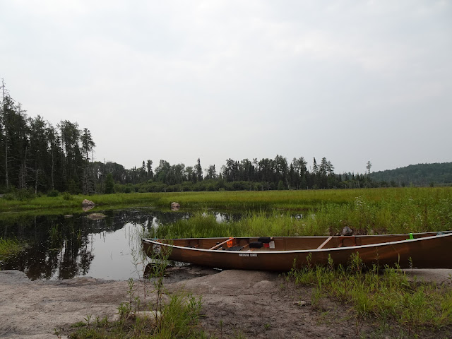
Finally finished the big portage and arriving at the Stuart River
Peaceful moment on the Stuart River
One of the portages along the Stuart River
But that's not all. At the mudpit my husband showed me that his wood laminate portage yoke cracked. He did the best he could with duct tape, and on we moved. We found the 6 mapped portages along the Stuart river along with several extra carryovers due to beaver dams. Along the route we ran into quite a few beavers. One smacked its tail at us quite near the boat giving us all a good laugh.
Desolate view along this portion of the Stuart River
Perfect circular reflections in the water
Just climbed over a big beaver dam
Another portage along the Stuart River
A beautiful morning on the Stuart River
Gorgeous Flower
Another Portage
Climbed over a beaver dam and slogged through the mud just down
from this last portage into Stuart Lake
Day 1 Map: EP#19 to Stuart Lake Island Campsite #1825
The cherry on top of the portage sundae was found just before the sixth and last mapped portage into Stuart Lake. A beaver dam forced us to portage through the squishy mud about 8 rods and struggle in shallow soft mud to paddle about 20 feet to the actual portage. Someone had marked the portage with a cairn, which answered our questions as we scanned the rock shore looking for a path through the trees. When we arrived at Stuart Lake, we found only one other party on the lake that day.
We took the island campsite on the southwest end of Stuart Lake, and made one of my favorite dehydrated camping meals. This dehydrated Spanish rice meal contains tomato, onions, corn and black beans with dehydrated taco meat garnished with crushed Fritos and cheese. A quick thunderstorm hit after our meal, and soon passed.
Our daughter relaxed in her hammock and we in our camp chairs. We saw only one other party in camp on the lake, the other campsites sat vacant. Delighted with the view from our site, we decided to settle in with the local snakes and frogs and spend two nights here before moving on to Crooked Lake.
Day 2
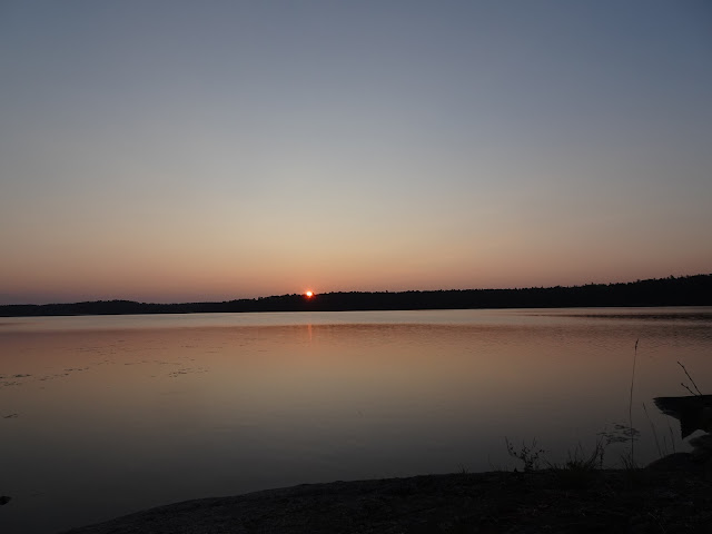
I plunked down into my campchair in the early gray. Barely able to see anything but the faint sunrise trying to form accross the lake, I added some water to my mueslix with powdered milk, and waited for the sunrise. I combed my wind-tangled hair, and did some stretches. Then I waited some more. In time, the sunrise over Stuart Lake provided color and brilliance, setting the tone for a gorgeous, peaceful day in camp. Soon the other group left the lake and we found ourselves alone on Stuart Lake for the day.
For lunch we had dehydrated shepherd's pie. After dishes I took a swim. My husband fixed the broken yoke with a stick for reinforcement and tied it on with some spare tarp rope. I watched swans, chased frogs, and got close to a little bird scavaging for crumbs. We swam, relaxed, and enjoyed the day and one another. For dinner we ate dehydrated sweet and sour chicken and rice with peas. Before we knew it, night fell ending Day 2.
Gorgeous flowers in camp
More Wildflowers
... and more wildflowers
Gorgeous view of Stuart Lake from Camp
Another look at Stuart Lake from Campsite 1825
Day 3
Once again up before the sun, I enjoyed another meuslix breakfast and another round of stretching as I waited for daylight. The Day 3 sunrise came in hazy courtesy of the smoke from the 2023 Canadian wildfires. This day we would paddle and portage to Crooked Lake and look for a campsite on Sunday Bay. I really looked forward to the last portage of our route from Iron Lake over to Crooked Lake. This 133 Rod portage is home to Curtain Falls, one of my favorite beauty spots in the BWCA.
Sunrise Day 3, Stuart Lake
Our full packout is ready to go!
Along the portage from Stuart Lake to Fox Lake
Rush Lake
Dark Lake
After a peaceful sunrise, I woke our teenager and we packed camp, off to an early start. We paddled over to the portage into Fox Lake. The first stretch of paddling for the day across Stuart Lake pulled the cobwebs out of everyone's eyes. Now fully energized, we portaged between Stuart Lake and Fox Lake (292 Rods), paddled Fox Lake, portaged from Fox Lake to Rush Lake (65 Rods), paddled Rush Lake, and portages from Rush Lake to Dark Lake (71 Rods). As we paddled Dark Lake, we noticed these lakes were small and not so clear, we didn't feel drawn to camping on them despite the opportunity to have one of these small single-campsite lakes to ourselves.
We saw no one on any of these lakes or portages, until we crossed the portage from Dark Lake to Iron Lake (90 Rods). We arrived at Iron Lake and saw a couple of groups on the water. The breeze picked up and we dug in, paddling three miles across Iron Lake and over to the portage into Crooked Lake. Along this portage the gorgeous Curtain Falls roars along the border between Canada and the United States in all of its waterfall glory.
May Day 3: Stuart Lake to Campsite 1877 on Crooked Lake, Sunday Bay
We thought we might have company on the portage from Iron Lake to Crooked Lake, but we saw no one, so we stopped by the falls for a lunch of cheese, sausage and minibagels. We took our obiligatory waterfall photos before setting off onto Crooked Lake. We saw no one paddling or in camp on Crooked Lake.
We paddled into Sunday Bay and took Campsite 1877 on the southwest end of Sunday Bay. After we enjoyed dehydrated spaghetti for lunch, we noticed the wind and clouds had really picked up, so we scrambled to set camp. Thankfully we had time to enjoy a swim and some hammock time before a thunderstorm chased us into our tent.
Strange colors in the sky after the evening storm
Day 4
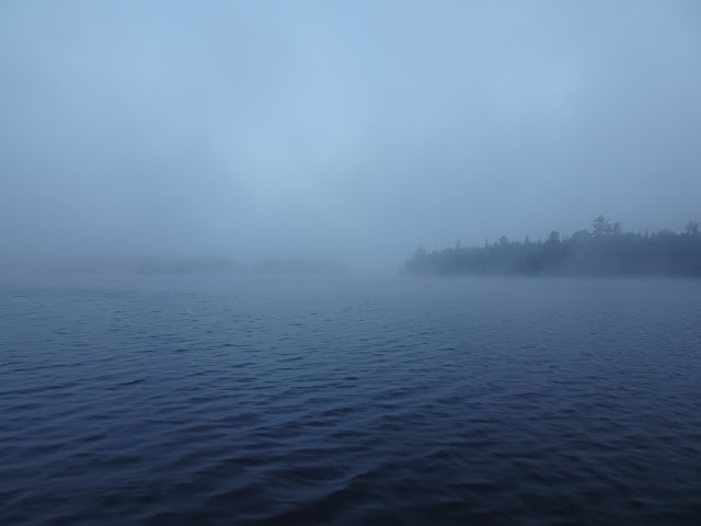
At sunrise the nearest trees accross the bay were obscured in a cold sea of white. The fog hung around for hours, giving a slightly damp feeling to nearly everything. Eventually the fog dissipated, giving way to a cold, windy day with an occasional peak at the sun and occasional light rains. When everyone rose for the day, we warmed our stomachs with a very satisfying hot freeze-dried meal, Peak Biscuits with Sausage Gravy.
Misty Morning on Sunday Bay
Can finally see a little bit of something across the lake
Our tent in the mist
The fog finally lifting!
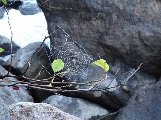
Spider web highlighted by droplets of mist
Given the wind and the fact that Crooked Lake is a relatively big lake with no portages along our route for the next 16 miles, Day 4 turned out to be a good day to hang out on our campsite and rest up for a big day of paddling on day 5. We expected to see a parade of boats coming through Crooked Lake as it is part of the border route, but we saw no one all day. We enjoyed dehydrated mashed potatoes with dehydrated ground beef with melted cheese for lunch and dehydrated red beans with rice for dinner.
Sun came out for a little while!
Then the cloudy skies and occasional rain returned
A rock wearing a crown of ferns in camp on Sunday Bay
Sliced boulder on Campsite 1841
Interesting berries
Another split boulder
Our campsite on Sunday Bay
Evening sky Day 4
Goodnight!
Day 5
Up with the moon and looking forward to the day's paddle, I poured some filtered lake water in my mueslix and powdered milk. Loons called and the wind whispered in the trees. This would be another great day in the Boundary Waters. I thought about Lower Basswood falls 15.5 miles away, and started doing stretches and mobility exercizes. I needed to loosen my shoulders to go the distance.
The moon over Sunday Bay
Not much to show for a sunrise
Ready to paddle towards Lower Basswood Falls
A cloudy morning
Approaching Table Rock
How did they get the little rocks (legs) under there?
One of the pictograms
Bird pictogram
Deer and/or moose pictograms
The gorgeous cliffs where the pictos can be found
Day 5 Map: Crooked Lake from Sunday Bay to Campsite 1550 near Lower Basswood Falls
We slowed down to admire Table Rock, and saw nobody on that campsite. We also slowed down to look at the pictograms on the cliff. We started to see people as we approached Lower Basswood Falls. The closest campsites to the falls were taken, so we took Campsite 1550 were still close enough hear the falls. We had paddled 15.5 miles and were ready to relax and enjoy watching all the groups paddling back and forth to look at the sights: Lower Basswood Falls, Table Rock, and the pictograms.
Our gorgeous view from camp
Dehydrated enchillada rice with dehydrated ground beef and Fritos
Evening is coming in camp
Goodnight Day 5!
Day 6
We woke to a cold, drizzly morning on Day 6 of our family's 2023 Boundary Waters canoe trip. We planned to see Lower Basswood Falls and Last Falls, and then start to slowly backtrack back to our entry point. Because we got an early start, we had all the time we wanted at the falls. We spent some time climbing around the the rocks and checking out the falls from all the angles as light rain fell.
Leaving Campsite 1550, morning Day 6
Lower Basswood Falls
Lower Basswood Falls
Day 6 Map: Lower Basswood Falls to Campsite 1580
After a time we started heading north and east on Crooked Lake. Mist and rain continued to fall maintaining the cold dampness of the day. We paddled to Campsite 1858 between Wednesday and Thursday Bay. The waterproof camera did not adequately showcase the remarkable views from this campsite in all directions.
On a sunny day, the views from this campsite would have been amazing. The only really good spot for the tent was out in the open on the rock. Normally, this would be too much sun, but on Day 6 the sun never showed itself, leaving the atmosphere cool and fine inside the tent. The mosquitoes thrived abundantly on this campsite and buzzed and bit while the damp cold settled into our bones. We turned in early and were glad to warm ourselves in our sleeping bags.
Crooked Lake
Campsite 1851
We spent much time hiding from the rain under our tarp
Swans
The view from camp
Day 7
Another wet, gray morning greeted us on Crooked Lake. We rose early and left Campsite 1858, paddling in the rain through Thursday Bay and most of Friday Bay. When the rain stopped for an hour or two, we took a rest break on Campsite 1867 on the far side of Friday Bay, snacked on some granola bars and watched the clouds drift by. The campsite had some remarkable pinks in the bedrock, which doesn't much show here in the gray-lit photographs. In person the colorful rocks appeared quite striking.
Taking a rest break on Friday Bay
Break time!
Map Day 7: Crooked Lake from Campsite 1589 to Campsite 1876 on Sunday Bar
After our break, we decided to look for a campsite on Saturday Bay. However, for the first time in the trip we found most of the campsites full rather than empty. But...it was a Saturday. Who wouldn't want to camp on Saturday Bay on a Saturday in the BWCA?
Campsite 1876 in Sunday Bay
Dehydrated Beef Stroganoff
We paddled over to Sunday Bay and took island campsite 1876. I made dehydrated beef stroganoff, and we set up camp. We saw a huge gathering of ducks, about 80 of them, hanging out near camp. The highlight of this campsite was climbing up a large rock and taking in the expansive view of Crooked Lake. This day the weather forecast called for 0% chance of rain, and we received the full bonus on our 0% as it started raining once we reached the campsite and rained on and off all afternoon until after our dinner of dehydrated hashbrowns and precooked bacon.
Six of seven of the eighty ducks hanging around our campsite
Crooked Lake from Campsite 1876
Crooked Lake
No sunset view this evening from the big rock
Beautiful flowers on Campsite 1876
Day 8
Seeing the sunrise felt like meeting a long lost friend on Day 8. Our family embraced the dry skies for our paddle over to Iron Lake. We felt ready to leave Crooked Lake for smaller lakes and do some portaging.
Sunrise over Crooked Lake, Day 8
Morning pink, Day 8
Overjoyed to see some sun, morning Day 8
Ready to go look for a campsite on Iron Lake
With Crooked Lake now like mirror glass, we paddled towards to the portage between Crooked Lake and Iron Lake. Although we'd been there before and we know what to do, I still felt my stomach flutter when I thought about paddling anywhere near the top of Curtain Falls, but we found the portage easily. As we paddled onto Iron Lake, the sun brightened the sky. We found Campsite 1841 open, and decided to take it.
A rest break at Curtain Falls
At the bottom of the falls
Day 8 Map 8: From Campsite 1876 on Sunday Bay, Crooked Lake to Campsite 1841 on Iron Lake
One of the views from Campsite View from Campsite 1841
The expanse of sunny rock provide a perfect drying opportunity for all of our wet clothes and shoes. We dined on Cajun corn chowder, a lentil based meal, and watched the parade of canoes go by. Most of our trip had been quiet, only Iron Lake and the small area on the Basswood River between Wednesday Bay and Lower Basswood Falls seemed to have people around. The highlight of the evening, our best of trip sunset, went on for more than an hour. Each time we though we'd seen the most vibrant of colors the sky suddenly grew even more vibrant with color.
The sun starting to set
Our campfire in the kitchen below camp
Sunset proceeding
More sunset
The sunset continues
Evening pinks
The color show continues
A flash of yellow with the pinks
Wow! Fire in the sky!
The fire is slowly going away
Amazing campsite!
Canoe at sunset
My husband at sunset
A grand goodnight right to the end!
Day 9
On a windless Day 9 morning, I poured water into my mueslix with powdered milk and watched the twinkling stars and summer moon fade as dawn came to Iron Lake. We quickly packed, now efficient from more than a week of practice. Today we would return to Stuart Lake. Iron Lake tends to be pretty choppy with even a little bit of wind, we felt blessed to be able to paddle off into a still morning.
The morning moon
Awaiting sunrise
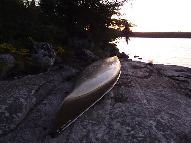
Our canoe at dawn's first light
We paddled Iron Lake enjoying the stillness, marvelling at the blue of water and sky. We saw plenty of loons and a soaring eagle. One of the loons allowed us to come quite close, I suppose it worried more about what the lurking eagle might be up to than it did about us. From Iron Lake we portaged over to Dark Lake.
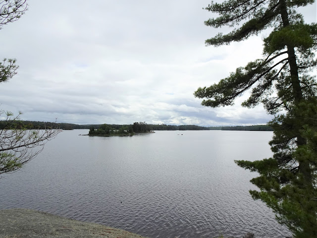
Iron Lake
Iron Lake
Loon on Iron Lake
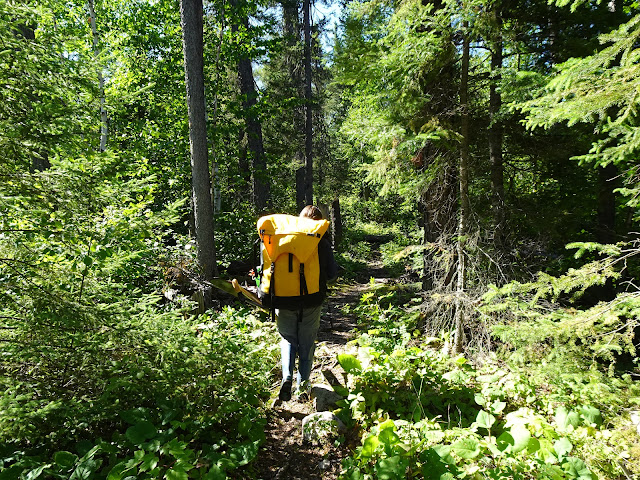
Portage trail
Dark Lake
I felt glad we had no plans to camp on Dark Lake, as the water looked dirty and the campsite didn't appeal. From Dark Lake we portaged over to Rush Lake which has an island campsite. Again, the lake was not as clean as many of the Bounday Waters lakes and the campsite didn't look inviting. We continued on to the portage into Fox Lake, home to another campsite that also did not appeal. We did the 292 rod portage from Fox Lake to Stuart Lake, and all agreed we now felt quite ready for a campsite.
Rush Lake
Fox Lake
Fox Lake
Portaging the canoe
Portaging from Fox Lake to Stuart Lake
Ferns on the portage trail.
Swampy area on the portage trail from Fox Lake to Stuart Lake
Signs of autumn
More along the 292 Rod portage from Fox Lake to Stuart Lake
We made it to Stuart Lake!
Day 9 Map: From Campsite 1841 on Iron Lake to Campsite 1823 on Stuart Lake
On Stuart Lake we took the campsite on the peninsula seen on the right had side from the protage. The campsite had great views, but a little too much open sun exposure. On this hot ninth day of our trip, we chased shady spots around the campsite. My daughter rested in the hammock for the remainder of the day, while my husband moved his chair from one patch of dissappearing shade to the next. I took a swim and wandered around the campsite feeling a little sad to be ending the trip the next day.
View to the north from camp
Someone built cairns all over this campsite
This squirrel had quite alot to say to me!
Another cairn
View of camp from another vantage point
My daughter spent her day here
Being the last full day of our trip, we raided the food barrel. We had dehydrated lemon chicken orzo for lunch and dehydrated hashbrowns with applesauce and bacon for dinner. In between we took everything we found in the barrel and greedily turned it into snacks. A bit of gouda, a scrap of flatbread, a piece of jerky - you've got yourself a fine finger sandwich! One does get hungry on the ninth day of a trip in the BWCA. In fact, our daughter had rationed her treats the best and ended up making $10 bargaining with her dad for the privilege of eating a handful of her Kind bars.
We enjoyed being the only people on the lake until after dinner when two other groups showed up, one from the direction of the entry point and the other from the direction we had traveled. Now two other campsites were filled and we heard the cheerful sounds of other campers chopping wood and woo-hooing from accross the lake.
Sunset time
I can finally show the view to the west, the sun was to bright all day
Goodnight!
Day 10
On Day ten, we woke to a windy morning on Stuart Lake. I felt in no hurry to get going, today we'd leave the BWCA and go back to our lives in the rat race. My daughter and husband, on the other hand, hurried, excited to be getting back to civilization for a clean shower, a restaurant meal, air conditioning and a night in our own comfortable beds.
Good morning Day 10
Canoe at sunrise
Pte-sunrise
Sunrise
We breathed loudly and dug in. Paddling across Stuart Lake into a headwind, we drew closer to our the first portage of the morning as the wind continued to pick up. We crossed the portage and got ready to do the portion of the return trip I dreaded most remembering it from Day 1. Across from the Stuart Lake to Stuart River portage, the river is nearly dried up due to a beaver dam. One must exit the canoe in the muckiest of river muck, and portage through the muck around the beaver dam. This time I managed to posthole, sinking into the muck well past my knee with the heavy barrel on my back. Recovering my leg and my boot left me panting for breath.
First portage of Day 10
Portaging around small rapids
Sunk into the mud and nearly lost a boot
There are 6 mapped portages along the Stuart River from the entry point along the Stuart River to Stuart Lake. Starting from Stuart Lake they run 72, 19, 68, 56, 99 and 433 Rods in length. Due to beaver dams there are several unmapped portages as well. Overall, the trip out runs in the upstream and net uphill direction. Between our mostly against the wind direction of travel, the day's heat, and the too overly fast pace we were taking, this made for an exhausting travel day.
At a portage along the Stuart River
Another portage landing
Stuart River
Stuart River
More Stuart River
Climbing over a beaver dam
This beaver dam was pretty impressive
Sunny day on the Stuart River
High vantage point on one of the portages
Mucky!
We are officially off the river and doing the last portage of the day
Starting the 430 Rod portage back to the parking area
Portaging
A small bit of water on the portage, just deep enough to make us get into the boat
That took about 2 paddle strokes, now we're back on foot!
Day 10 Map: Stuart Lake Campsite 1823 to Entry Point 19 Parking
The uphill slog is over!
If you find yourself contemplating doing the Stuart River Entry Point #19, I'd advise considering entering at Stuart River but exiting a different entry point. To repeat the whole slog from Stuart Lake back through the entry point requires paddling upstream, climbing low to high over beaver dams, and doing the 433 Rod portage in the uphill direction. More importantly, backtracking is not nearly as exciting as travelling new ground.
Backtrack we did, until just like that our trip ended. If it even makes sense to say, nothing really happened on this trip, yet everything happened. The trip reawakened something within me, to the point I felt everything on the trip comprised reality and my life at home comprised a dream. But now here I am, and as I sit on my comfortable sofa after a long day at work I write. I write while waiting for the laundry to spin in the washing machine, and for dinner to finish cooking in the oven...and I long to be back on the water. But I am here, and the water is there, and wait I must.
That's all for now, let's get outdoors and keep our wild places wild.


.JPG)


.JPG)


.JPG)










.JPG)




.JPG)




No comments:
Post a Comment