
The forecast had called for a sunrise temperature of 16°F, but the actual temperature was -3°F. I dug through my pack looking for an extra warm hat and gloves and wished I had brought a warmer coat. Today I planned to hike the connecting route between the Point Beach and Mishicot Segments of the Ice Age National Scenic Trail (IAT). I headed north on Woodlawn Drive and then east on Randolph Street, also known as County Road V at a brisk pace to warm up my hands and toes. As I headed east on County Road V, I noticed a steady stream of traffic and spent a good bit of time hopping into the snowy shoulder of the road to give the cars some extra room. The sun rose over the farmsteads, and a delightful dusting of snow coated the occasional patch of trees making the world look magical.
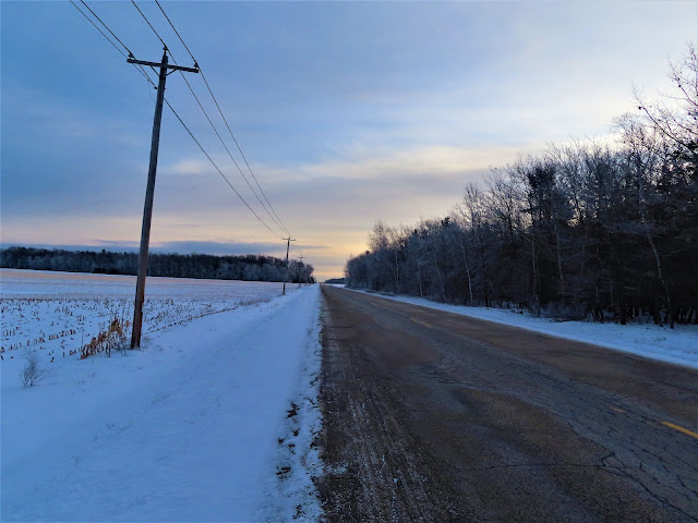


Crossing Wisconsin State Highway 42 required some patience and care. After crossing Wisconsin State Highway 42, the traffic slowed down, and the walk became more peaceful. I continued in that direction until I had about 5 miles on County Road V behind me. Then, I turned north onto Lakeshore Drive and walked about a quarter mile to the terminus of the Point Beach Segment of the Ice Age Trail. At the trail, I turned back and hiked the route by which I had just arrived in reverse.


The bitter cold and wind had my joints aching. Although a 10.6 mile round trip typically presents a comfortable walking distance, in this case I felt glad to end my walk, start up the heater in my car, and rest my cold, achy joints. That's all for now, let's get outdoors and keep our wild places wild!


Map of the connecting route
Difficulty - Easy to moderate, one small hill, dealing with traffic, and some ice and snow give it a ranking beyond easy.
Trail Conditions - The connecting route traverses country roads, started out -3°F (-19°C) warming up to 13°F (-11°C).
Location - Parked at the Mishicot Elementary School (on the weekend) in a visitor spot.
No comments:
Post a Comment