Footpaths through the prairies, wetlands and forests of Wisconsin beat road-walking most times in my book. I typically like to avoid fast moving cars and narrow shoulders - with one exception. Deer hunting season becomes road-walking season for me, and for many an Ice Age National Scenic Trail (IAT) hiker. When walking connecting routes along the IAT during deer gun season, it is not unusual to hear gunshots, see deer dashing across country roads, and to feel great relief to be on road rather than on trail. In fact, many segments of the IAT are closed during deer gun season. It is in this spirit I road-walked between the Walla Hi and Manitowoc Segments of the IAT.
I broke the road-walk into several shorter walks. From the Walla Hi County Park I walked 9.8 miles (15.8 km) to St. Nazianz Oschwald Park. I created my own route rather than following the guidebook's suggested route, so that I could make an approximately 10 mile walk with good car or bicycle parking at both ends.
I returned another day to walk from St. Nazianz Oshwald Park to the Cato Falls County Park, now getting back onto the route suggested by the guidebook. To complete the final stretch I walked from Cado Falls County Park to the Henrt Schuette Park in Manitowoc.
 |
| Walla Hi Couinty Park on Mueller Road near Kiel, Wisconsin |
From Walla Hi County Park, I headed east on Mueller Road and then north on Cedar Lake Road. Gunshots rang out and I saw plenty of hunters coming and going from roadside parking and in farmer's fields. At the public parking area for Cedar Lake, I turned west. From here I headed past small lake-homes for about a quarter mile, then turned first northwest and then north on Louis Corners Road. Now I headed through Wisconsin farm country. When I reached Louis Corners (County Road XX and Louis Corners Road), goats bleated loudly and church bells rang.
 |
| Along Louis Corners Road |
 |
| Along Louis Creek Road |
 |
| If you like old barns, this is your walk, along Louis Corners Road |
 |
| The church, Louis Corners |
 |
| The sun warms the barn along Louis Corners Road |
If you like charming views of old barns and farmland, and I for one do, this is your route. After another mile on Louis Corners Road, I turned left on County Road X. This stretch of road felt busy with fast moving traffic. After about a half mile, I felt relieved to turn north onto quieter Wilke Lake Road.
Never say never, I saw Sasquatch on Wilke Lake Road. No, really, I have the photo to prove it! Sasquatch aside, in terms of live animals I did see plenty of horses, cows and goats along the roadwalk between Walla Hi County Park and St. Nazianz. I even saw a mule.
 |
| Sasquatch! |
 |
| Horses along Wilke Lake Road |
After about one mile I turned right onto Point Creek Road and walked another mile. At Greendale Road, I turned left and walked about three miles. The relatively flat stretch of Greendale Road moves north offering nice farm country views. After about three miles on Greendale Road, I followed Church Street east and then northeast, about a quarter of a mile into the village of St. Nazianz.
 |
| View of St. Nazianz church from West Street |
I turned north onto West Street, which made a nice shortcut to Main Street St. Nazianc (County Road C). At Main Street I turned east, and was at Oschwald Park in less than a quarter mile. Once completed, it was time to turn around and backtrack back to the car.
 |
| Stars over St. Nazianz |
 |
Map from Walla Hi County Park to St. Nazianz Oswald Park
© OpenStreetMap contributors
https://www.openstreetmap.org/copyright
|
On the stretch between the St. Nazianz and Cato Falls County Park, I parked at Oschwald Park in St. Nazianz and headed east on County Road C. I shook of the 12°F cold (-11°C) and passed the village office, which looks like it is built in an old school house near a historic cabin. On the way out of town I passed the New Holland agricultural equipment plant and Miller Implement as I left the village of St. Nazianz.
 |
| The St. Nazianz Village Office |
 |
| New Holland Agriculture, St. Nazianz |
I headed north on Marken Road admiring barns and fields along the way for about two miles. Then, I turned east and walked about a mile on Hillcreek Road past more farms. Then I turned north on County Road J and started walking towards Valders.
 |
| Along County Road J south of Valders |
 |
| Between St. Nazianz and Valders |
 |
| Between St. Nazianz and Valders |
 |
| Old Barn between St. Nazianz and Valders |
 |
| Heading into Valders on County Road J |
Heading into Valders on County Road J, I passed a couple farms with mules and horses as well as the usual dairy farms found along most of the Central and Southern Wisconsin connecting routes. Valders is a small town, offering the usual churches, bars and a dining establishment. I found it interesting that at the main crossroads, CBD had also made it for sale in small town Valders.
 |
| Along Couny Road J |
 |
| Enjoying the sun on a very cold morning |
 |
| Valders village limits |
 |
| Walking the sidewalks of Valders |
 |
| One of the local churches en route |
 |
| At the main crossroads with County Road J and State Highway 151 in Valders |
At the the Valders Memorial Park I continued north on County Road J passing the quarry, and then after 3 miles on County Road J, veered right to head east on to County Road JJ for 2 miles. I headed towards Clark Mills. In Clark Mills (town of Cato) there I found an interesting wood worker's property to enjoy. I continued east on County Road JJ to the Lower Cato Falls County Park.
 |
| Valders Memorial Park |
 |
| The Quarry |
 |
| Lower Cato Falls County Park |
 |
| Map from St. Nazianz Oschwald Park to the Lower Cato Falls County Park |
© OpenStreetMap contributors
https://www.openstreetmap.org/copyright
When I reached the Lower Cato Falls County Park it was time to turn back and hike to my car left waiting for me in St. Nazianz. As I walked, I got to thinking that one of the nice things about hiking this time of year in Wisconsin, is the short hours of daylight. This means later morning sunrises and early sunsets seen across miles of wide open fields.
 |
| Sun colors! |
 |
| More sun colors |
 |
| Sky across the wide open fields |
On the next go around, I headed back to the Lower Cato Falls County Park, this time heading east towards the City of Manitowoc Segment of the Ice Age Trail. While it was 25°F (-4°C), windy and felt like a winter's day, but the snow had melted making it look like autumn once again. I began at Lower Cato Falls County Park heading east to finish the connecting route from the Walla Hi Segment of the Ice Age Trail to the Manitowoc Segment.
 |
| Lower Cato Falls County Park along County Road JJ in Manitowoc County |
First, I headed 2 miles (3.2 km) east on County Road JJ over a couple of hills and then took a slight right onto Middle Road where the terrain flattened. I continued heading west on Middle Road for over 3.5 miles (5.6 km) through Wisconsin farm country admiring farmsteads and fields where I spotted deer roaming in the distance at several instances.
 |
| Deer in the distance along Middle Road. |
 |
| Middle Road Farmstead |
 |
| Icy pond along Middle Road |
When I arrived at Alverno Road, I headed south for just under one mile (1.6 km). Then, I headed east on Custer Street for just under 2 miles (3.2km), heading towards the city of Manitowoc. When I arrived at the traffic lights, I headed north, following bicycle trail along Rapids Road, on which there is a Fleet Farm including a gas station. For the through hiker, if you head south on Rapids Road for about a half mile rather than going north, you will see there are shopping, lodging and dining opportunities.
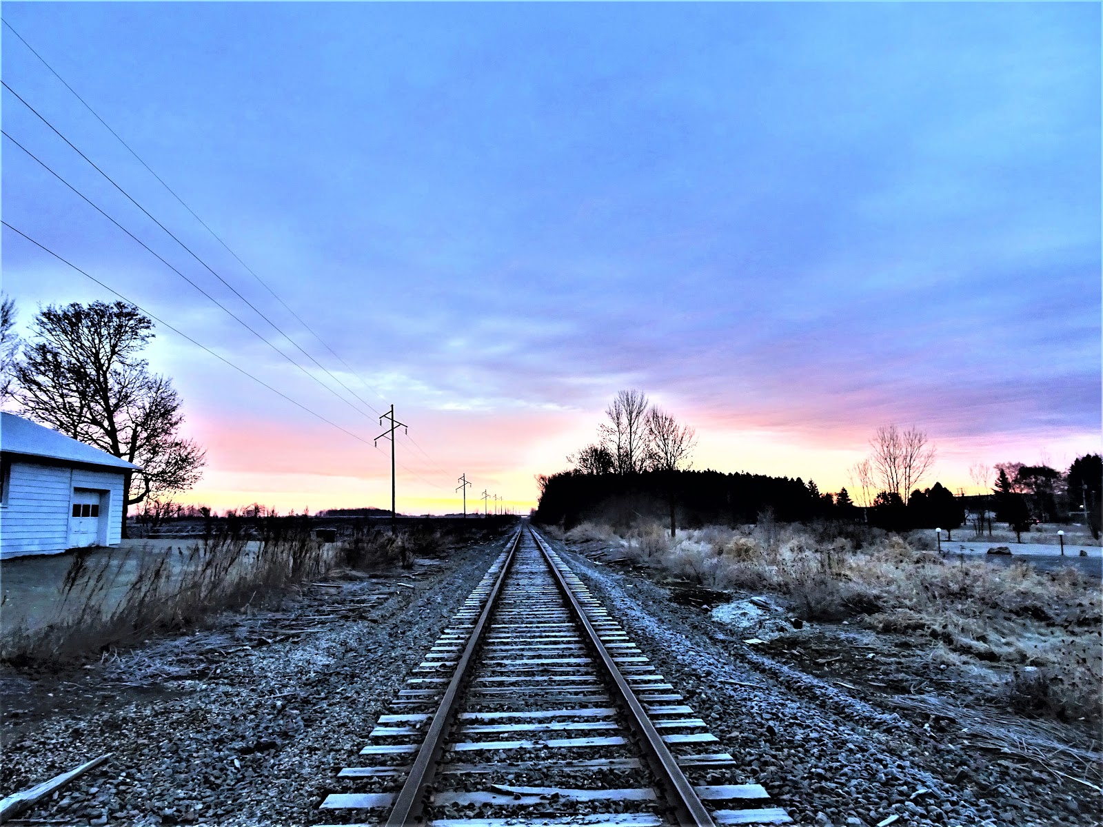
 |
| Railroad crossing along Alverno Road Road |
 |
| Former Wisconsin Governor Walker is gone but apparently not forgotten |
 |
| Along Custer Street |
When I arrived at Broadway Street I convened with the Manitowoc Segment of the Ice Age Trail. I took Broadway Street to the parking area at the playground of the Henry Schuette Park where I ended my hike. Then I turned around and headed back to the Lower Cato Falls County Park.
 |
| Henry Schuette Park |
 |
| Map from Lower Cato Falls County Park to City of Manitowoc Schuette Park |
© OpenStreetMap contributors
https://www.openstreetmap.org/copyright
 |
| Map of Entire Connecting Route from the Walla Hi Segment to the City of Manitowoc Segment of the IAT |
© OpenStreetMap contributors
https://www.openstreetmap.org/copyright
Deer hunting season is a great time to knock out some road miles. After a stretch like this I am always glad to get back on trail. That's all for now, let's get outdoors and keep our wild places wild!
Total Distance Covered - 27.3 miles (43.9 km). Breaking it into smaller chunks: 9.8 miles (15.8 km) one way from the Walla Hi Country park to St. Nazianz Oschwald Park, 8.5 miles (13.7 km) one way from St. Nazianz Oschwalk Park to Lower Cato Falls County Park, and 9 miles (14.5 km) one way from Lower Cato Falls County Park to Schuette Park in Manitowoc.
Difficulty - Easy, with some occasional hilly spots.
Trail Conditions - Most of the road was easy to walk with minimal traffic; however, the traffic was fairly busy on County Road JJ and on County Road X. 12°F to 36°F (-11°C to 2.2°C).
Highlights - Views of the Sheboygan and Manitowoc Rivers, old barns, horses and goats. New Hollands agricultural equipment, a Sasquatch on Wilke Lake Road.
Total Ice Age Trail Miles to Date - Total official IAT trail distance completed to date - 462 miles (740 km).
Location - I parked at Walla Hi County Park on Mueller Road about 4 miles from Kiel, St. Nazianz Oschwald Park on County Road C (Main St.) in St. Nazianz, and the Lower Cato Falls County Park on County Road JJ.
Amenities - There is trail head parking for the IAT at Walla Hi County Park. There is a bar and church in Louis Corners, Cedar Lake is just along the route on Cedar Lake Road, and the City of St. Nazianz offers a few small town amenities including parking at Oschwald Park, a post office, a small convenience store, and dining at Meat's Opera House.
The Village of Valders offers a Memorial Park, a pub, a bar & bowl, a Piggly Wiggly Grocery Store, a couple of filling stations and the Willows Supperclub.
The city of Manitowoc offers the most in the way of amenities. Manitowoc offers multiple lodging, shopping and dining options and has multiple parks with the Manitowoc River running through the city and Lake MIchigan on the east end of the city. Tourist attractions include the Wisconsin Maritime Museum, the USS Cobia Historical Landmark, Rahr West Art Museum, and the West of the Lake Gardens.


No comments:
Post a Comment