After passing through a pine grove the trail entered areas of prairie and forest, the highlight being a viewing bench on the Mecan River. The trail recrossed 9th Avenue at another DNR parking area. After a short time hiking, I encountered the Wisconsin Operating Engineer Training grounds which is a private property area and the hiker is advised to stay on trail. Also, please note the area is signed as closed to hikers during the deer gun hunting season. This area is located between County Road GG and the DNR parking area on 9th Avenue.
 |
| Along the Mecan River Segment of the IAT |
 |
| Yellow blaze through a pine plantation. |
As I hiked the Mecan River Segment of the IAT, I enjoyed many beautiful views of Wisconsin in the snow. Great photo opportunities presented themselves. But would I get a good photograph of an eagle?
 |
| Picturesque farm view from the IAT. |
 |
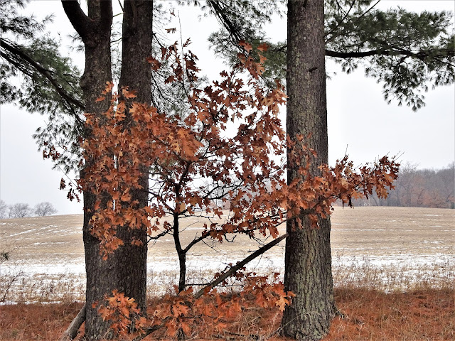
| Leaning oaks along the Mecan River Segment of the IAT |
 |
| Signage warning of private land and deer hunting closure |
 |
| Mobile Skills Crew project marker at the County Road GG crossing |
After crossing County Road GG, I soon entered the Mecan Springs area. Eagles, often seen in this area, perch in the trees that over look the springs below the IAT. I scared up an eagle which quickly flew away, a distant blur by the time I figured out where it went. As I watched it go beyond the trees I wondered which tree it had been sitting in.
Video of me fumbling to photograph the second eagle.
I looked up, and there perched above my head was another eagle. My golden opportunity! I would get my photograph after all. As I fumbled to get my camera focused, steady and ready the second eagle flew away. Truly one of those "I wish I had my camera ready" moments.
 |
| Drawing near the overlook of the springs. |
 |
| The Mecan Springs on a gray winter's day. |
As I hiked through the Mecan Springs Area, the views of the Mecan Springs rewarded my efforts hiking in the snow and ice. But I would not be rewarded with a good eagle photograph. I had scared them off. The best opportunities seem to be earned by sitting patiently in a blind and waiting hours for the perfect composition. I have not developed the patience for this. I like to hike. Move on, move on.
 |
| Stopped for a snack in the snow at the bench overlooking the Mecan Springs. |
If you are in the area, I definitely recommend a stop at Mecan Springs to give your legs a stretch on the IAT. There's a good chance you'll see bald eagles. Leaving the Mecan Springs area, I crossed Chicago Road and headed across a large, hilly field and saw a turkey. I am quite surprised I didn't see deer, but I did see plenty of deer stands.
 |
| Headed toward the expansive field. |
 |
| Follow the yellow blazes - hiking the IAT! |
 |
| Erratic near the end of my hike. |
After crossing the expansive field, I re-entered the wooded area and came to a large wooden bench at the spur trailhead of the dispersed camping area (DCA). Multi-day hikers are welcome to hike in the DCA at no cost. The DCAs are flattish, but lumpy and you will have to go for a hike and dig a hole if a bathroom is what you need. Maximum occupancy at a DCA is 6 people, and if you bring 6, it will be tight. Do not expect a fire ring. Beyond the DCA, I cut through a pine plantation and up a snow covered dirt road to the trail head parking on Buttercup Drive.
 |
| Map |
Total Distance Covered - The Mecan River Segment one way is 6.6 miles (10.6 km), 13.2 miles (21.2 km) out and back.
Difficulty - Moderate for this time of year due to the ice and snow on the gently rolling hilly spots.
Trail Conditions - The trail is well-blazed and highly used. Some patches were very icy and slippery, 18°F (-8°C).
Highlights - Snow and eagles! Views of the Mecan River.
Total Ice Age Trail Miles to Date - Total official trail distance completed to date - 406 miles (649 km).
Amenities - DNR parking along along Highway 21 and 9th Avenue. The Highway 21 parking area is about 4 miles from Coloma. Coloma offers restaurants (Subway and A&W), lodging, and gas stations.
Location - Parked in the DNR parking area on Wisconsin Highway 21.


Are fires permitted in the DCA of this segment?
ReplyDeleteI am sorry I didn't see your comment, unfortunately I didn't check for comments as I am accustomed to not getting any. I am sorry if this is too late. I did not see a fire ring there when I went through. Please do not have fires in DCA areas that do not have a fire ring. Have a great hike!
ReplyDelete