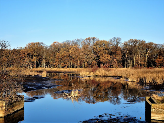
Despite sticking to the roads, I did see deer and sandhill cranes on the move as hunters stirred them up, and did hear a few gunshots. I wore blaze orange for extra visibility, and didn't worry about it. As I walked along County Road F, I saw a hunter in a pickup truck collide with a deer, taken so by surprise I forgot about the camera in my hand.
 |
| Starting the connected route at the Portage Canal Segment |
 |
| Goats along County Road F on the connecting route |
 |
| Along State Highway 33 along the connecting route |
I broke this hike into 2 parts, and enjoyed two early morning weekend walks. First, I hiked out of Portage along State Highway 33 for less than a mile, then headed north on County Road F. The connecting route along County Road F offers views of farms, fields, deer stands, and a few patches of wetland. This day provided a fantastic opportunity to view sandhill cranes and deer, as the hunters wandering around had them stirred up and on the move.
 |
| French Creek Wildlife Area along County Road F |
 |
| French Creek Wildlife Area along County Road F |
 |
| Along the connecting route |
 |
| Interesting hand cranked pump on mailbox |
 |
| Beautiful barn along the connecting route |
For the second part, I parked at the John Muir Memorial County Park and headed south along County Road F until I reached my previous endpoint, then I flip-flopped back to my car. Along this stretch of County Road F, I enjoyed watching birds at the French Creek Wildlife area and watching the Amish hang clothes to dry on a cold November morning. A friendly horse that was out trimming the lawn by mouth in the early morning, was pulling a cart on my flip flop. Doing these hikes in the early morning on weekend days, allowed me to hike along County Road F without much traffic rather than doing the longer hikes down some of the smaller farm roads which adds a couple of miles.
 |
| Map of Route from Portage to John Muir Memorial County Park |
That's all for now. Let's get outdoors and keep our wild places wild.
Total Distance Covered - 21.6 miles (34.8 km) out and back total, the connecting route is 10.8 miles (17.4 km) one way.
Difficulty - Easy.
Trail Conditions - The roads can at times be busy, 38°F (3°C) - part 1, 30°F (-1°C) - part 2.
Highlights - Watching the migrating sandhill cranes. Saw plenty of deer on the move stirred up by hunters.
Total Ice Age Trail Miles to Date - Total official trail distance completed to date - 325 miles (520 km).
Amenities - Parking at John Muir County Park and the Portage Canal Segment trail-head of the IAT. Also parking at the wayside along State Highway 33 in Portage and at the Keist-Dury Trailhead in Portage along State Highway 33. A BP gas station at the corner of State Highway 33 and County Road F. There is also a historic site along State Highway 33, the historic Fort Winnebago Surgeon's Quarters. Vault toilet is available during warm weather season at the John Muir Memorial County Park.
Location - Parked at the wayside along State Highway 33 in Portage (Part 1) and at the John Muir County Park (Part 2).
Location - Parked at the wayside along State Highway 33 in Portage (Part 1) and at the John Muir County Park (Part 2).

No comments:
Post a Comment